Fit and Healthy on Route 66 – Rogers Parkway to Memorial Park

June 30, 2012
Trailhead for Rogers Parkway, Brentwood, Missouri

Trailhead for Rogers Parkway

If you’re traveling on the Manchester alignment of Route 66 through St. Louis County and are in the mood for a short, easy bike ride or a walk for you or a canine companion, try the Rogers Parkway in Brentwood, Missouri. Brentwood is a small city but has a lot of little parks, most with water, some with restrooms. You’ll pass through several during the route I’m about to describe. You won’t see anything spectacular, but you’ll enjoy charming older suburban neighborhoods with large trees and pleasant shade. The trail is pet-friendly with plastic bag dispensers for waste and a water fountain with a basin at dog’s height. If you don’t know the area well you’ll want to download and print out this map to take with you.

If you’re traveling west on Manchester, start looking for the trailhead shortly after you cross over Hanley Road. The trailhead will be on the right, in between American Locksmiths and Brentwood Place Apartments. You’ll find an asphalt trail heading north that takes you to Broughton Park. Follow the trail until you reach Swim Club Road, where you’ll cross over to the other side of the street.

Intersection of Trails

Intersection of Trails

Continue until you get to an intersection of asphalt trails. Turn right, and you’ll pass some handball, tennis, and volleyball courts. This is Hanley Park. You’ll see some signs along the way suggesting different fitness exercises that you can do if you like. The trail splits in two, and the more interesting route is to the right. You’ll cross a creek and follow along it for awhile on the Lee Wynn Trail until you get to Oak Tree Park. If you feel like doing some hill climbing, you can continue past the park and up a ridge to explore the streets a bit. If you’re not in the mood for climbing a hill, head back the way you came until you get past Hanley Park and back to the intersection. You can turn left here and get back on the Rogers Parkway, or you can turn right and continue for a short distance into Memorial Park. If  you’re hungry or thirsty, there is usually a snack stand set up here. If you care to head toward the huge American flag toward the northeast, you’ll come across a large shopping center that has a Trader Joe’s and a Target, both places where you can pick up some items for a picnic lunch. (If you turn right at the huge flag and continue for a few blocks, you’ll see some light rail tracks – turn left and there is the Brentwood I-64 Metrolink station if you want to explore more of the St. Louis area – bring your bike on board). If you don’t want anything from the shopping center, I recommend turning around in Memorial Park and heading back the way you came at this point – you’re roughly 2/3 of the way through the entire route if you’ve taken no detours.

If you’re on foot, you’re probably satisfied with the length of your excursion, but if you want a little more, you’ll notice some dirt trails on the right as you head back. Explore the small wooded area if you like.

If you’re on a bike, you might want to extend your ride considerably. If so, I recommend looking for Eulalie Ave. (this is the spot where you crossed the road previously upon reaching Swim Club Road) on the way back. It’s a little confusing because if you look left, the road is called Dorothy and if you look right, the sign is missing. Nevertheless, take a right turn and you’ll come to an intersection with Brentwood Blvd. Use the light and cross Brentwood Blvd. here with care – it’s very busy and the drivers are not necessarily attentive to cyclists or pedestrians.

Once you’ve crossed Brentwood Blvd., continue west on what is now Litzinger Rd. Look for four Lustron houses on your left. Continue for several blocks on Litzinger until you get to Tilles Park, a large park in the city of Ladue with a nice trail, more fitness stations, water, restrooms and more. There is a small lake with a shelter if you’ve brought a picnic lunch. Go around the park as many times as you like, then head back to Brentwood Blvd. on Litzinger and cross back over. Make a right when you reach Rogers Parkway and you’ll be back to the trailhead shortly.


Fit and Healthy on Route 66 – Floating the Meramec River

April 15, 2012
Meramec River Float

Meramec River Float

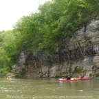
On Saturday, April 7, 2012, I joined members of the St. Louis Adventure Group (SLAG) for a float on the Meramec River. The Meramec is a prominent feature of the Route 66 corridor from Phelps County to St. Louis County, where it makes it’s way toward the Mississippi River. It is visible from Route 66 in St. Louis County and crosses paths at Valley Park and Route 66 State Park. Once you leave St. Louis County you will have to travel a little way off of Route 66 to see the Meramec River at spots such as Onondaga Cave State Park, Meramec State Park or Robertsville State Park. In between the parks are additional points where you can put in and take out boats.

The Missouri Department of Conservation has provided maps to show where the put-in points are. On our April 7 float, we put in at Pacific Palisades Conservation Area (147.3 on the map below) and Allenton Access (154.2).

Meramec River Access Points
(click for larger image)

This was a fairly short float. We stretched it into about three hours by really taking our time. It was also easy – there are only a few spots where you really have to pay attention to navigate around snags that always seem to be right where the current is swiftest! Our group was made up of experienced paddlers but the Meramec River should always be respected regardless of experience level – it is deep and fast enough to drown people, so if you are going to float it please be sober, make sure you can swim, and use a personal floatation device. You might consider carrying a knife on your person to cut yourself free in case you get tangled in anything. Read here for more safety tips and legal guidelines.

After the float, several members of our group headed to Super Smokers (a Route 66 Association of Missouri Business Member) for a delicious BBQ dinner. We were very impressed by the swiftness at which they served our large group. The food was fantastic!

If you would like to try one of Missouri’s many beautiful float streams but don’t own a boat or need a shuttle, check out our list of Business Members – there are a couple of outfitters on there who will happy to tell you about their offerings.

See photos of our float:

Carolyn’s photos

SLAG member photos


Fit and Healthy on Route 66: Queeny County Park

February 27, 2012
Winter Hike at Queeny Park

Winter Hike at Queeny Park

Queeny Park is just a few minutes north of the Manchester Road alignment of Route 66 as it traverses West St. Louis County. The park has two entrances. If you are traveling West on Manchester, turn right on Mason Road and look for the entrance that says “Dog Museum”. If you are traveling East on Manchester, turn left on Weidman Road to access the park. There is no way to drive from one entrance to the other without leaving the park, but you can walk between the two entrances.

Queeny Park in Summer

Queeny Park in Summer

When I was young, I used to love to go to Queeny Park to play on the very advanced and unusual playground equipment for the time. Lately I’ve used the park for biking and hiking. There are some paved trails and some gravel surfaced trails. The park is hilly so either way you’ll get a good workout – it’s especially good in my opinion for practicing hill climbing if you’re new to mountain biking. You’ll get enough of a challenge to give you something to work toward but most of the hills are not so difficult that you’ll be overly discouraged. The park is large and there are enough trails to enjoy a moderately long or short excursion depending on what you are looking for.

Yes you read the first paragraph correctly – at the Mason Road entrance there is indeed a Museum of the Dog. I remember the controversy surrounding this Museum when it was first proposed. A lot of people thought it sounded ridiculous – I haven’t visited it myself. It consists of a collection of artwork devoted dogs in an historic circa 1853 house. I’ve had very enjoyable visits to a barbed wire museum and a vacuum cleaner museum which probably sound like very odd attractions to most, so who knows, it might be good – perhaps it’s worthy of the tradition of eccentric attractions on Route 66. There are lots of dog walkers in the park so there does appear to be a large built-in audience! If you’re traveling Route 66 with canine companions this might be an especially good stop to make – dogs are allowed in the museum and you can give your pets and yourself a workout on the trails.

Photos of Queeny Park

Queeny Park Web Site


Fit and Healthy on Route 66: Powder Valley Conservation Nature Center

February 13, 2012
Deer at Powder Valley Conservation Nature Center

Photo by Mark Stauter.

On February 12, 2012 a meeting of the Route 66 Association of Missouri Publication Committee was held in Kirkwood, MO. In the past after these meetings I have headed to nearby Powder Valley Conservation Nature Center for a hike after the meeting. On this occasion, Mark Stauter joined me. There are three trails to choose from. First we took the 0.70 mi Broken Ridge Trail then we switched over to the 1.20 mi Hickory Ridge Trail. Both trails are paved with asphalt. This makes for easy footing in dry weather but do be careful if conditions are at all wet or icy because there are steep hils and the asphalt could get slippery.

The trails are short, but hilly enough to give you a decent workout. Despite the close proximity of interstate highways and homes, there is a lot of wildlife to see. We saw deer, chipmunks and many birds including tufted titmice and robins. There was such an abundance of robins in one area that the sound of them rustling through leaves to look for food was quite striking. Not a rare sight by any means, but a delight! I’m not certain but I may have seen some dark-eyed juncos. We definitely heard woodpeckers. If you happen to come here when the visitor center is open, it has excellent exhibits and you can borrow binoculars for birdwatching.

For directions and more information, go to Powder Valley Conservation Nature Center

More photos on Carolyn’s Facebook page


Fit and Healthy on Route 66: Kaintuck Hollow Trail

July 13, 2010
Zeno's in Rolla

Impromptu mini Chrysler convention at Zeno's

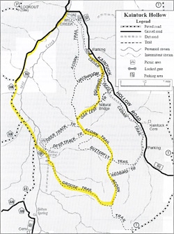
On Saturday July 10, the Route 66 Association of Missouri held a meeting in Richland at The Cave Restaurant and Resort. Any time we have a meeting that is anywhere near Rolla, several of us end up staying the night at Zeno’s and making a weekend out of it. I was in the mood to actually get my mountain bike dirty for a change, so I consulted my copy of the book Show Me Mountain Biking to see if there were any suitable trails near Rolla. I decided to try the Kaintuck Hollow Trail in Mark Twain National Forest, near Newburg. I printed out a forest service map to take with me since the network of trails looked like it might be challenging to navigate without getting lost.

Breakfast from Cookin' from Scratch

Robert at Cookin' from Scratch. Quinn and Natalie in the background.

On Sunday morning, after mass at St. Patrick’s and a hearty and delicious breakfast at Cookin’ From Scratch in Doolitle, my brother Larry and I headed for the trail. Since Larry does not have a mountain bike, the plan was to park at the second parking area past the Mill Creek Recreation Area and for Larry to walk part of the way while I biked on ahead of him. He had brought a book to read while waiting for my return, and the first parking area looked like a much more pleasant place to rest and read a book, so when he was done walking he moved my Jeep to the first parking area.

Kaintuck Hollow Trail Map

Here is a scan of the forest service map marked in yellow to show the (probable) route I ended up taking. Click on the thumbnail to see a larger image.

Butterfly

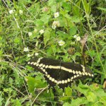
Butterflies were abundant on the trail

I encountered water on the trail right away. I’m not afraid to get my mountain bike wet, but some of the water was muddy so I walked the bike through to avoid splashing myself with muddy water. The first segment on the Cedar trail was lovely, a nice easy ride with wildflowers all around. That soon changed when I turned onto the Squirrel trail and started to climb uphill. I don’t mind admitting that this portion was WAY beyond my ability and I walked the bike uphill. I don’t see how anyone could ride a bike up this part – the trail here was mostly washed out ruts with fist sized rocks and loose gravel. But apparently people do – I saw some red paint on a rock from someone wiping out, I presume. Even walking the bike up was not easy.

Pine and Oak forest

Pine and Oak forest

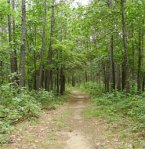
Once on top of the ridge, the trail became quite rideable and lots of fun. The terrain here was mostly hard packed dirt or small gravel with an occasional rock through open glades, oak forest and pine forest.There was occasional sand and mud and frequent fallen branches which for the most part I could ride right over. I had to dismount a few times to get the bike over a log. Occasionally there was a trail marker where two paths met – the trail markers here have little graphical icons indicating what section you’re on, such as an Acorn or a Deer Track – but all the intersections I came across were not marked so for much of the time I was not really sure where I was.

When I started to descend from the ridge, I thought I was on the Redbird trail and I planned to meet the road at the bottom and take it back to the Mill Creek Recreation Area where the Jeep was parked. The long ride down was a highlight of the ride. The trail was not so steep that I feared for life and limb, but steep enough to be challenging and fun. It was necessary to steer very carefully to avoid large rocks and ruts and other hazards, and to avoid building up too much speed. My legs sure appreciated the rest! I was dismayed however when I got to the bottom – there was a trail marker there and it did not look like a Redbird – it looked more like a Grouse! I was on the opposite side of the ridge from where I wanted to be. But at least I knew where I was.

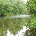
Mill Creek

Mist over Mill Creek

I decided to head for the nearest road and take it back to the parking area even though it was the long way around – ascending that ridge again was too exhausting to contemplate! My dismay soon turned to delight at the interesting scenery around me. There was old silo covered with vines and graffiti and a low water bridge crossing beautiful Mill Creek – this time I rode through the shallow water with no trouble. A mysterious mist hovered over the stream, leading me to believe that Wilkins Spring, which I knew was close from the map, was feeding into the stream nearby.

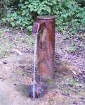
Artesian Well

Artesian well at Mill Creek Recreation Area

I soon found the road and was back at the parking site much more quickly than I expected. There is an artesian well here with a spigot from which you can get cold, potable water. I got a towel out of the Jeep and made a beeline to the well to wash the sweat, dirt and spiderwebs off of my weary limbs and face. Ahh! I refilled my water bottles and relieved my thirst with the delicious spring water. The three water bottles I brought were barely enough for this trail. What a great way to end a ride! I gave my wrinkled sweat-stained map to a couple who were about to begin their ride since the one they had was not as detailed.

I will be back to this area – there are many interesting features I either missed or want to explore more closely. I highly recommend this trail to anyone who wants a fairly strenuous hike or off-road bike ride and wants to feel like they are in the middle of nowhere and enjoy the beauty of Ozark scenery while only a few miles from the Interstate.


Fit and Healthy on Route 66 – Meramec Greenway Fenton Trail

July 6, 2010

The Meramec Greenway was established in 1975 and follows the Meramec River 108 miles west from it’s confluence with the Mississippi River south of St. Louis. The western portion of the Meramec Greenway roughly follows the path of Route 66. There are plans for 60 miles of trails along the Greenway, and several segments are completed and accessible from Route 66.

Yesterday I rode my bicycle on the Fenton Park Trail portion of the Meramec Greenway. This trail segment passes through three parks – Unger Park north of I-44, and Fenton City Park and George Winter Park south of I-44. The total distance from the Unger Park Trailhead to the George Winter Park Trailhead is about 5 miles. There is parking at all three parks, but Fenton City Park, which is in the middle, is the only one with water and restrooms. For the time being, I don’t recommend parking at George Winter Park because there is a bridge out and that portion of the trail is closed.

I stretched my ride to about 10 miles by taking the following route – I parked at Fenton City Park, then rode to George Winter Park until I encountered a barrier (beyond this the bridge is out, so don’t go back there), at which point I turned back to Fenton City Park, then continued to Unger Park to where the trail ends at a railroad track. There was a sign saying the trail was flooded but I found it to be dry. However there was sand on parts of the trail which could mean it was flooded recently. There was an opportunity to do some exploring past the Unger Trailhead by riding around on the streets in the industrial park area beyond the train track, but I decided to save that for another time because I was so hot I was tempted to fling myself into the river! Then I turned around and rode back through Unger Park and back to Fenton City Park where I concluded my ride.

There are a few rough spots here and there on the paved trail, but road bikes should be able to make it. Be careful if you encounter sand, it’s very slippery. A good portion of the trail is shaded by trees, this is nice but keep an eye out for fallen branches. There are a few places where you have to exit the paved trail and share the road with cars, but these spots I found to be lightly traveled and relatively peaceful. Along the way you will see a forested area, a small lake, the river, a golf course, and the old section of Fenton which gives you a nice small-town feeling. You could make your ride longer by exploring more of the streets and doing some loops around Fenton City Park.