Fit and Healthy on Route 66 – Floating the Meramec River

April 15, 2012
Meramec River Float

Meramec River Float

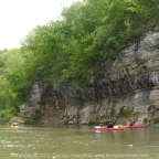
On Saturday, April 7, 2012, I joined members of the St. Louis Adventure Group (SLAG) for a float on the Meramec River. The Meramec is a prominent feature of the Route 66 corridor from Phelps County to St. Louis County, where it makes it’s way toward the Mississippi River. It is visible from Route 66 in St. Louis County and crosses paths at Valley Park and Route 66 State Park. Once you leave St. Louis County you will have to travel a little way off of Route 66 to see the Meramec River at spots such as Onondaga Cave State Park, Meramec State Park or Robertsville State Park. In between the parks are additional points where you can put in and take out boats.

The Missouri Department of Conservation has provided maps to show where the put-in points are. On our April 7 float, we put in at Pacific Palisades Conservation Area (147.3 on the map below) and Allenton Access (154.2).

Meramec River Access Points
(click for larger image)

This was a fairly short float. We stretched it into about three hours by really taking our time. It was also easy – there are only a few spots where you really have to pay attention to navigate around snags that always seem to be right where the current is swiftest! Our group was made up of experienced paddlers but the Meramec River should always be respected regardless of experience level – it is deep and fast enough to drown people, so if you are going to float it please be sober, make sure you can swim, and use a personal floatation device. You might consider carrying a knife on your person to cut yourself free in case you get tangled in anything. Read here for more safety tips and legal guidelines.

After the float, several members of our group headed to Super Smokers (a Route 66 Association of Missouri Business Member) for a delicious BBQ dinner. We were very impressed by the swiftness at which they served our large group. The food was fantastic!

If you would like to try one of Missouri’s many beautiful float streams but don’t own a boat or need a shuttle, check out our list of Business Members – there are a couple of outfitters on there who will happy to tell you about their offerings.

See photos of our float:

Carolyn’s photos

SLAG member photos


National Trust for Historic Preservation Awards Landmarks Association of St. Louis, Inc. A Preservation Grant from National Trust Preservation Funds

March 25, 2011

Grant Will Go Toward Master Plan for the Historic Route 66 Bridge over the Meramec River

St. Louis, MO (March 22, 2010) Today, Landmarks Association of St. Louis, Inc. was awarded a $3,500 grant by the National Trust for Historic Preservation from the Missouri-Kansas Preservation Fund. The seed grant funds will launch the first phase of a multi-phased project to develop a master plan for the Historic Route 66 Bridge over the Meramec River.

Master Plan for the Historic Route 66 Bridge over the Meramec River

The master plan for the bridge will serve as a long-range plan for the future use of the bridge and its surrounds as historical resources. An economic feasibility study (which is part of the master plan) will examine preservation and rehabilitation costs, as well as physical enhancement opportunities such as the placement of overlooks, seating, handicap accessible viewing platforms, and educational signage in the park. These enhancements will help build an identity for the project, educate the public about the bridge as a historical resource, and distribute information about the process being undertaken currently.

The Meramec River Bridge is an important resource associated with Route 66 in Missouri. It was specifically constructed for the historic highway, and is one of only four similarly designed bridges in the state. When the road was bypassed by Interstate-44, the bridge was likewise evaded and fell into disrepair. The master plan funded by the grant is a critical step in stabilizing the bridge for future renovation and use.

Landmarks Association serves as fiscal agent for the bridge and has been working closely with the bridge’s stakeholders – a strong partnership of over twenty local, state and national organizations working to preserve the bridge as a vital tourism, recreational and historic asset.

“Without organizations like Landmarks and the Meramec River Bridge stakeholders, communities and towns all across America would have a diminished sense of place,” said Stephanie Meeks, president of the National Trust for Historic Preservation.  “The National Trust for Historic Preservation is honored to provide a grant to Landmarks, which will use the funds to help preserve an important piece of our shared heritage.”

The National Trust for Historic Preservation dispenses small grants for local projects through the National Trust Preservation Funds grant program.  The grants range from $500 to $5,000 and have provided over $5.5 million dollars of funding since 2002.  They are awarded to nonprofit groups, educational institutions and public agencies, and must be matched, at least dollar for dollar, with public or private funds.  Preservation Funds grants are being used nationally for such wide-ranging activities as consultant services for rehabilitating buildings, technical assistance for tourism that promotes historic resources and educating children about their heritage.  These grants are often the deciding factor on whether historic buildings or sites can be saved for future generations.

For more information on National Trust for Historic Preservation’s Preservation Fund grants, visit: www.PreservationNation.org/resources/find-funding/grants/.

About Landmarks Association of St. Louis, Inc.

Landmarks Association of St. Louis (http://www.landmarks-stl.org/) was incorporated in 1959 as a not-for-profit agency, focusing on the preservation, enhancement, and promotion of St. Louis’ (and the surrounding area’s) architectural heritage. The agency’s original goals addressed rampant destruction of the city’s historic buildings and landmarks prompted by urban renewal and slum-clearance. Today, Landmarks continues to focus on the preservation and enhancement of local and regional historical resources, encouraging sound planning and good contemporary design.

About the National Trust for Historic Preservation

The National Trust for Historic Preservation (www.PreservationNation.org) is a non-profit membership organization bringing people together to protect, enhance and enjoy the places that matter to them. By saving the places where great moments from history – and the important moments of everyday life – took place, the National Trust for Historic Preservation helps revitalize neighborhoods and communities, spark economic development and promote environmental sustainability. With headquarters in Washington, DC, nine regional and field offices, 29 historic sites, and partner organizations in all 50 states, the National Trust for Historic Preservation provides leadership, education, advocacy and resources to a national network of people, organizations and local communities committed to saving places, connecting us to our history and collectively shaping the future of America’s stories.

Fit and Healthy on Route 66 – Meramec Greenway Fenton Trail

July 6, 2010

The Meramec Greenway was established in 1975 and follows the Meramec River 108 miles west from it’s confluence with the Mississippi River south of St. Louis. The western portion of the Meramec Greenway roughly follows the path of Route 66. There are plans for 60 miles of trails along the Greenway, and several segments are completed and accessible from Route 66.

Yesterday I rode my bicycle on the Fenton Park Trail portion of the Meramec Greenway. This trail segment passes through three parks – Unger Park north of I-44, and Fenton City Park and George Winter Park south of I-44. The total distance from the Unger Park Trailhead to the George Winter Park Trailhead is about 5 miles. There is parking at all three parks, but Fenton City Park, which is in the middle, is the only one with water and restrooms. For the time being, I don’t recommend parking at George Winter Park because there is a bridge out and that portion of the trail is closed.

I stretched my ride to about 10 miles by taking the following route – I parked at Fenton City Park, then rode to George Winter Park until I encountered a barrier (beyond this the bridge is out, so don’t go back there), at which point I turned back to Fenton City Park, then continued to Unger Park to where the trail ends at a railroad track. There was a sign saying the trail was flooded but I found it to be dry. However there was sand on parts of the trail which could mean it was flooded recently. There was an opportunity to do some exploring past the Unger Trailhead by riding around on the streets in the industrial park area beyond the train track, but I decided to save that for another time because I was so hot I was tempted to fling myself into the river! Then I turned around and rode back through Unger Park and back to Fenton City Park where I concluded my ride.

There are a few rough spots here and there on the paved trail, but road bikes should be able to make it. Be careful if you encounter sand, it’s very slippery. A good portion of the trail is shaded by trees, this is nice but keep an eye out for fallen branches. There are a few places where you have to exit the paved trail and share the road with cars, but these spots I found to be lightly traveled and relatively peaceful. Along the way you will see a forested area, a small lake, the river, a golf course, and the old section of Fenton which gives you a nice small-town feeling. You could make your ride longer by exploring more of the streets and doing some loops around Fenton City Park.